A late season view to the north and Lake Aloha aka Medley Lakes 11/18/2013
By:
Mike Mullen | Added over 12 years ago.
With decent weather holding into late November I couldn’t resist a late season visit to the mountains. I had been thinking a lot about Horsetail Falls lately, and with its proximity to 13 named lakes, 14 if you include Lake Aloha, I settled on it as my gateway to accessing Desolation Valley.
I had heard about the Horsetail Falls route since I was a little kid. My father’s family used to spend a week in Phillips on Highway 50 each summer, and my Dad had told me many stories about climbing up Horsetail Falls with his Dad to fish the lakes of Desolation Valley. They would start in the dark with flashlights and heavy coats, stashing them when the sun came up, and then retrieving them on the way back after a long day of exploring and fishing.
And so on the morning of November 18, 2013 I left home at 4:15AM and stopped in Placerville for breakfast at 6:30. When I got to the trailhead at Twin Bridges, mine was the only car in the parking lot. After forgetting my lunch back at the car, it was 8:30 before I got on the trail. It was a chilly morning with high clouds, and not much sun. The hike starts out with a fairly mild climb over lots of open granite, and approaches Pyramid Creek where you hit the Desolation Wilderness boundary.
After passing into the Wilderness, I had trouble following the trail and decided to follow a rock cairn that took me up off the valley floor to the west. After getting up out of the trees, I saw that my options were to go back down through lots of brush or continue up the west side of the valley; the latter is what I proceeded to do. There was a faintly marked route up to a small valley draining parallel to Pyramid Creek a few tenths of a mile to the west. After about 600 vertical feet of steep climbing, mostly up long cracks in the granite with wonderful views of the falls, the terrain flattened out a bit, and I found a decent use trail that ran north past some unnamed lakes to the west of Avalanche and Pitt Lakes.
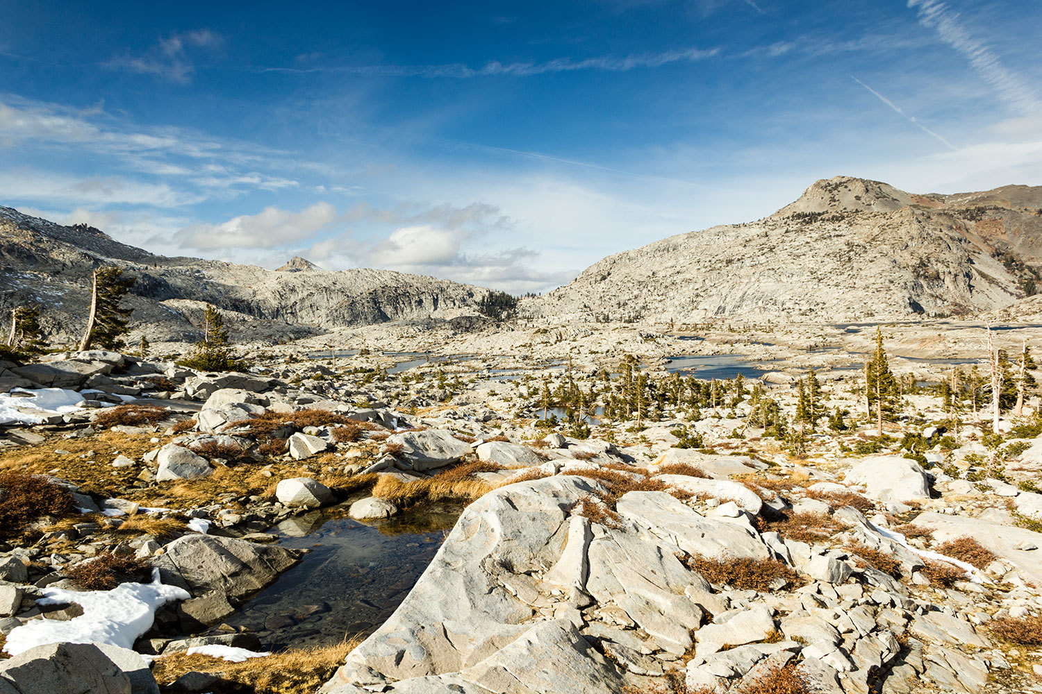
Around 11:00 I came out to an open high place where I saw Ropi Lake off to the right as well as Toem and Osma lakes. Pyramid Peak rose above the whole bowl of lakes with clouds wrapping around the summit. I decided to set off on a clockwise loop through the area to try to see as many lakes as I had time for. So I set off westerly and visited Osma Lake and Toem Lake before climbing up to Gefo Lake, passing an unnamed lake on the way up from Toem to Gefo. Looking back to the south there were lots of patches of snow in the shade. From Gefo Lake it is a nice walk northward to Pyramid Lake, with western views dominated by Pyramid Peak. Another bit of walking up a gentle grade to the north took me to deep Waca Lake. From here, looking north, I saw where Lake Aloha is and the cliffy bits of its bowl to the west and north.
Being pressed for time I decided to head over to American Lake to the east, but curiosity got the best of me as I came over the slight ridge between Waca and American Lakes. I decided to head north again to get a look at Lake Aloha. The water was very low so it looked like many different lakes, and seemed like some of the pools of water where at different elevations. Since I was at my turnaround time, I didn’t go down to the lake to investigate, but rather turned back to the South and skirted along the western shore of the long, narrow American Lake. Getting around the southwest end of American Lake was a bit tough, but quickly brought me to a view of Channel Lake. Keeping to the west of the creek and lakes I passed the very photogenic unnamed lake (which I have nicknamed Angle Lake) between Channel and Desolation lakes before coming down to Desolation Lake at its inlet.
I saw some small fish in the nearly dry creek above Desolation Lake. There was a thin skim of ice on part of the lake and the wind, which had really picked up, was blowing that ice up against and onto some rocks. This was causing an amazing tinkling and crinkling sound, like lots of glass breaking very far away. I kept to the west shore and had to climb up and over a rocky cliffy section before coming back to the lake where the creek runs out to Ropi Lake below. I was able to cross the creek at the outlet and head pretty much due south aiming to hit Ropi Lake at its southeastern corner. During this section between Desolation and Ropi lakes there are great views of Ropi and Toem Lakes along with Pyramid Peak.
From Ropi Lake I stayed to the east of Pyramid Creek and skirted along the eastern shore of Pitt Lake before crossing Pyramid Creek below Pitt Lake. Avalanche Lake was close by and I decided to take a break here to catch my breath for the decent of Horsetail Falls.
I had a nice rest, the sun actually came out and felt great on my back for a few minutes before the wind really picked up. I followed pretty close to the creek for a bit until it got very steep. From here there was a long traverse to the West along a horizontal crack in the rock. Definitely not a good place to fall. There seemed to be lots of routes to follow, and after picking my way down through open rock and boulder fields and brush, a better defined trail presented itself and led me down to the Wilderness Boundary sign. At this point I encountered the first person I had seen all day, and the unique spell of the solitude of the wilderness was broken, and I was eased back into everyday life.